hiking

My Backpacking Gear List

Dear reader: this article contains links to products and services that I may be compensated for, at no extra cost to you.


All of the gear I use for backpacking in 2020

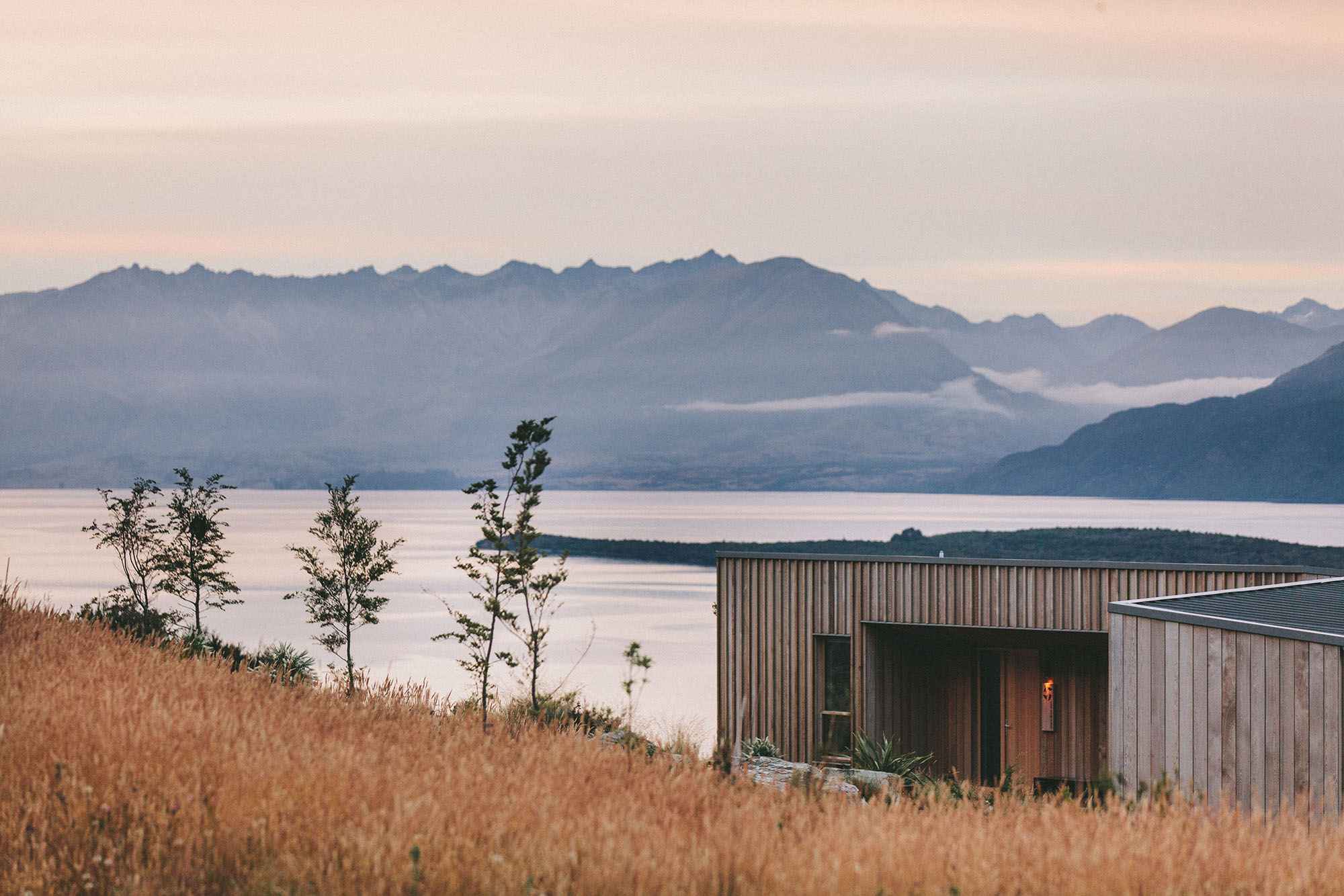
Backpacking in the mountains can provide one of the purest forms of happiness in our lives. The ability to get out of the city, the stresses of life, to be surrounded by nature and immersed in its tremendous beauty is a wonderful luxury we can all enjoy. It feels this year, more than ever, a backpacking trip to the mountains is sorely needed.

I’m often asked for recommendations on what to bring for day hikes to high mountain climbs, and everything in between. I’ve put together my gear list for overnight backpacking trips. I hope these can help you get a gear pack started, or help you refine what you already have for backpacking your hometown mountains and beyond!

In general, it is important to have these items when backpacking in the high mountains:

  • Lightweight Tent

  • Tarp

  • 60L or more Backpacking Pack

  • Sleeping Bag

  • Sleeping Pad

  • Stove and Fuel

  • Utensils

  • Food

  • Water and Water Treatment Tools/Tablets

  • First Aid Kit

  • Hiking Boots or Shoes

  • Appropriate Hiking Attire

  • Rain Jacket and Warm Clothing

  • Lightweight Day Pack

On top of this list, you should absolutely have the TEN ESSENTIALS:

  1. Knife - very necessary

  2. Headlamp - bring extra batteries

  3. Navigation - compass, map, GPS device

  4. Sun Protection - hat, sunglasses, sunscreen, etc

  5. First Aid Kit - include foot care and insect repellant

  6. Fire - matches, lighters, flint, stove

  7. Shelter - tarp or emergency bivy

  8. Extra Water - beyond minimum expectation

  9. Extra Food - beyond minimum expectation

  10. Extra Clothing - beyond minimum expectation

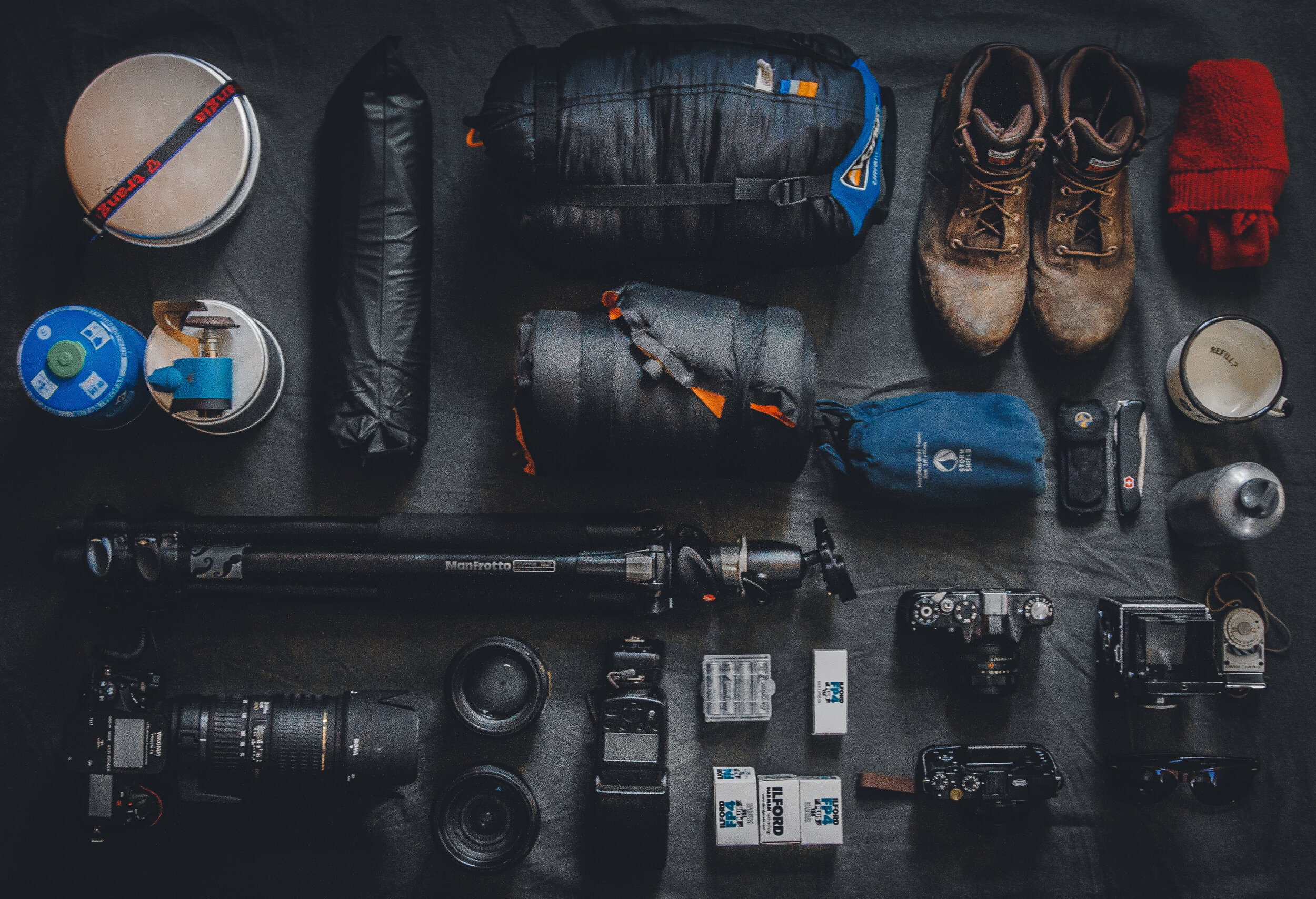
Alright, now that we have the basics under our belt, let me show you what I bring to the mountains on any given trip. Of course, this list can be adjusted depending on how many days I’ll be in the mountains, or how difficult the hiking will be. Let’s get to it! My typical backpacking gear for 2020!

Backpack

F Stop Gear Sukha 70L

What I love about the F Stop Gear Sukha Pack is that it is large enough to fit all of the camera gear I would normally bring on an overnight camping trip in the high mountains (see below), because of the ICU’s that keep everything neatly packed inside. With those ICU’s I am also able to bring my tent, sleeping bag, sleeping pad and any food/cookware that’s necessary.

This is a photography bag for the adventurer. They live up to that. I’ve taken my Sukha pack all over the high mountains of Taiwan, and will even use it on day trips because of how nice and neat everything packs inside.

Camping Gear

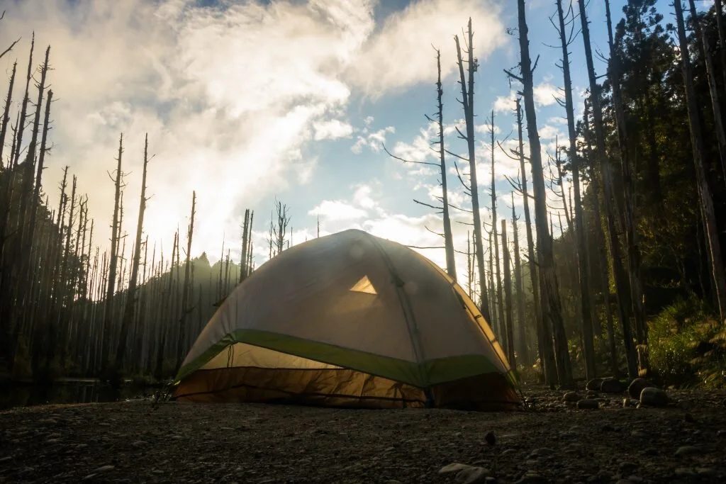
Kelty Salida 2 Person Backpacking Tent

I have taken this tent up in the high mountains of Taiwan backpacked with it in California and slept very comfortably every time. This Kelty tent fits two people comfortably, and is only 3lbs 14oz. The Kelty Salida backpacking tent comes with a pouch to fit the poles, rain fly, and tent neatly inside. This helps keep everything tightly packed in my backpack, and protects my other gear from the water and dirt that may accumulate on my tent overnight.

This tent has been on countless adventures and has held up spectacularly.

For friends and clients, I have a handful of Quechua two person tents that are very good for very cheap. They don’t pack as conveniently, but they can be attached to the outside of your backpack easily enough.

Forclaz Foam Sleeping Pad

This isn’t fancy, but it does the trick and is lighter than a feather, weighing only 200 grams. This sleeping pad is also incredibly cheap. You can buy it at Decathlon for 200 NTD (~$7 USD). They have Alu film on the sleeping surface to help against abrasions and to increase thermal insulation. For backpacking, this has worked wonders.

Sleeping Bags

My choice in sleeping bags is based on what’s easily available here in Taiwan. Typically I’ll bring sleeping bags from Decathlon, or from a local outdoor shop, Prince Outdoors, here in Taipei City. Which backpack you choose will heavily depend on the season, weather and elevation of your backpacking trip to the mountains. In the high mountains, above 3,000 meters elevation, I bring with me a -10 C tolerant sleeping bag. In the summer I’ll bring my…

Camping Feather Down Blanket

This comes in handy on so many occasions. I always bring this to the high mountains, or to normal camp trips. The down blanket stuffs into a malleable pouch, so it doesn’t take up much room at all in the bag, and is very lightweight. I use it as a pillow while its in the stuff sack, and it greatly improves the quality of my sleep!

If the night is too cold, I can stuff the inside of my sleeping bag with this as well, and I’m good to go. Conversely, if I am hammock camping in the summer I will sleep on top of this and the blanket will keep my back from getting too cold at night.

Sometimes this down blanket is enough to keep me warm all night, and I can skip bringing a sleeping bag with me.

ENO Double Nest Hammock

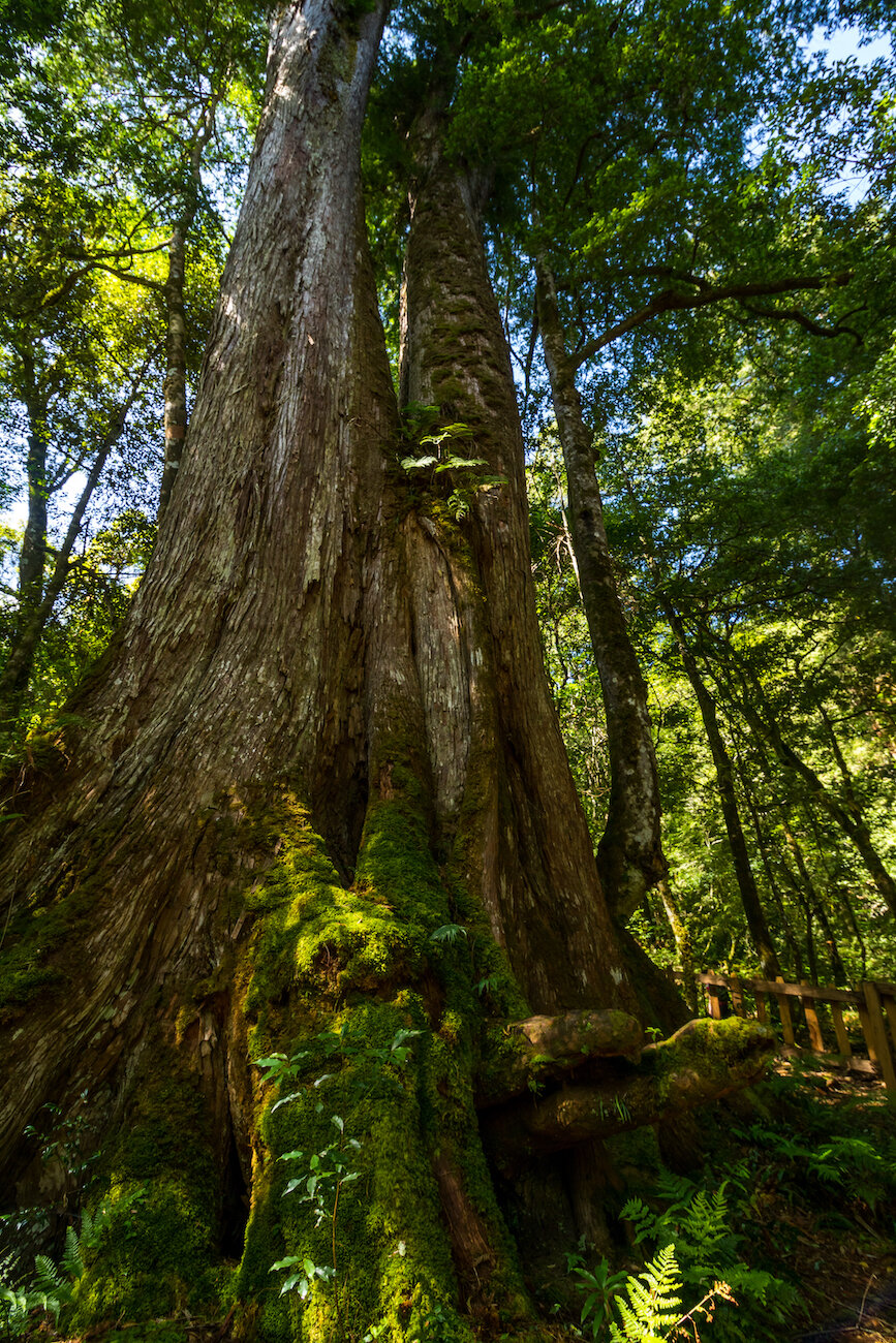
I wouldn’t bring my hammock to the high mountains, due to the lack of trees to hang it from, but I love hammock camping in lower elevation forests. It’s lightweight, easy to pack, and extremely comfortable to sleep in. One downside is no mosquito net, but I combat this by wrapping the hammock around me, like a cocoon.

I also bring my ENO Double Nest hammock when I intend to sleep in my tent. If the camping trip is more casual, I love throwing the hammock up and reading a book while laying amongst the trees. Sometimes there’s no better way to spend a day.

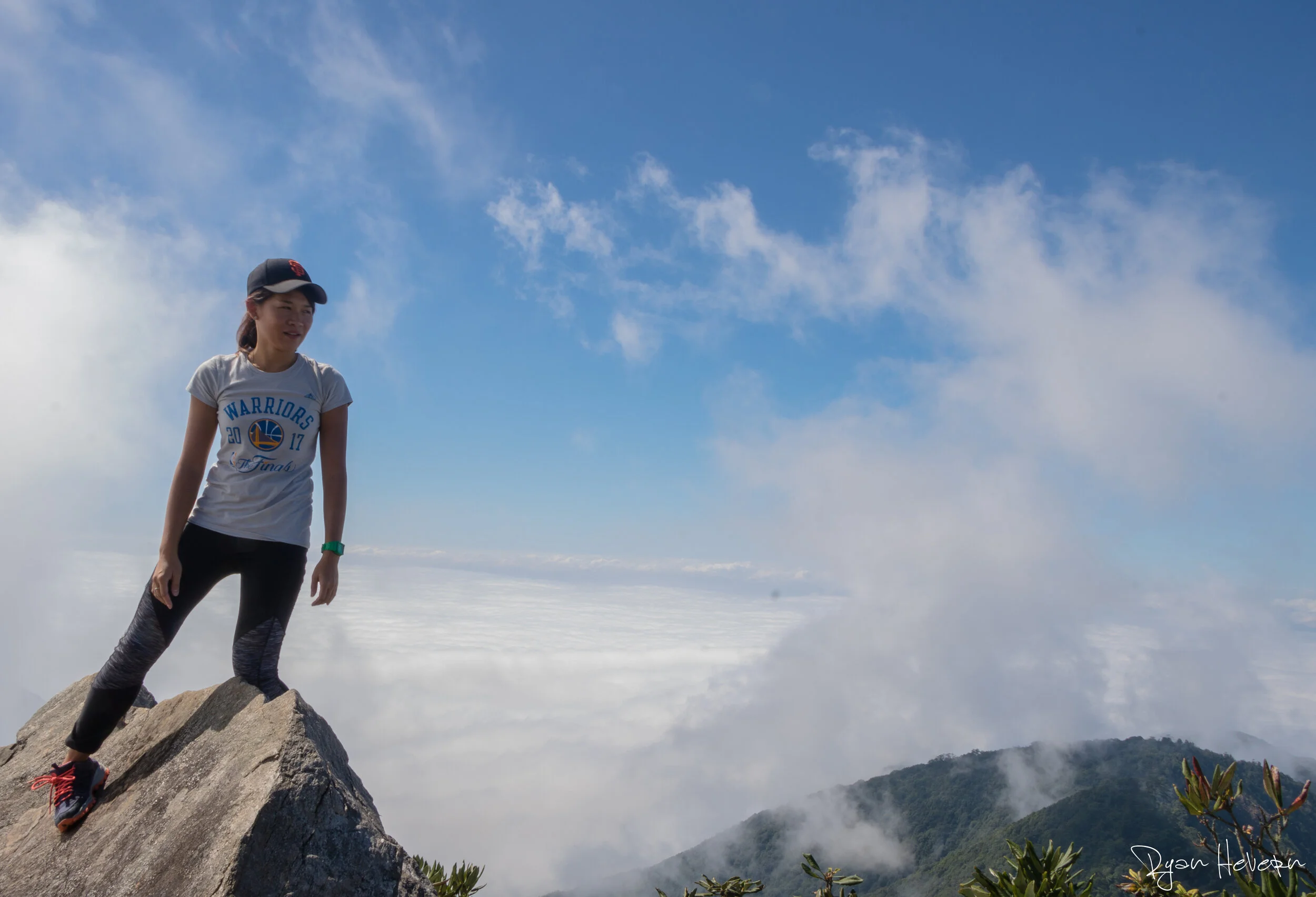
So there you have it! This is just about all the gear I use while camping and backpacking in the mountains and forests of Taiwan. This doesn’t even cover my camera gear that I bring with me on every trip as well!

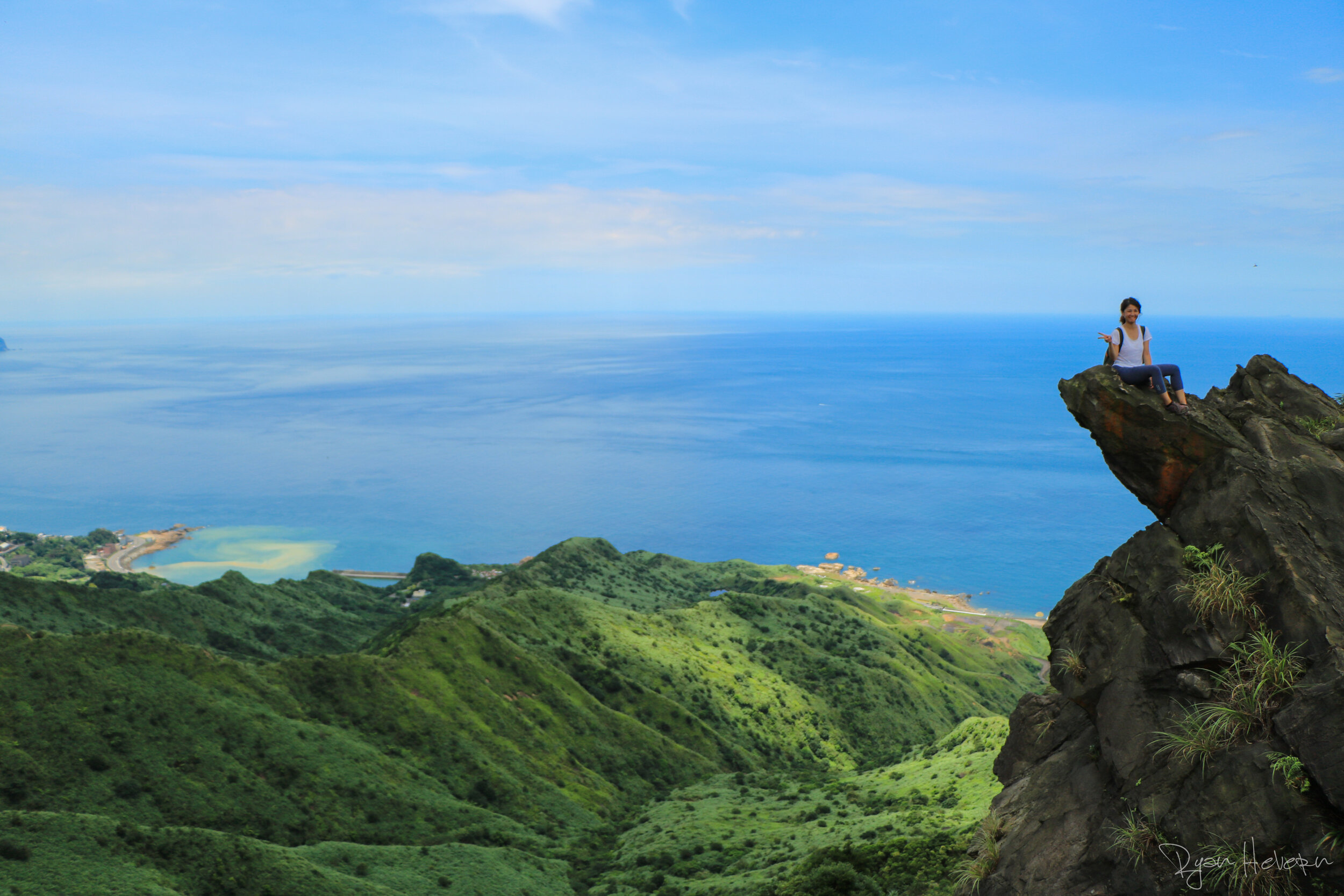
Get out and enjoy the outdoors, always Be Adventurous!


Check out more photos on my Instagram!

Gallery Block
This is an example. To display your Instagram posts, double-click here to add an account or select an existing connected account. Learn more

Ancient Tree Groves of Smangus and Zhenxibao

Smangus Zhenxibao Taiwan Hiking Indigineous Tribe Atayal Ryan Hevern Ancient Cypress Trees (16 of 52).jpg

Deep in the mountains of Hsinchu you can find Taiwan’s most remote indigenous village. At 1500 meters elevation, Smangus (司馬庫斯) has had an air of mystery surrounding it for many years. The Atayal village is known as a leader in community based tourism, keeping their authentic culture intact while only opening up to tourists in 1995,when the road to the village was first built. I recently had the chance to return to Smangus’ Ancient Tree Grove, as well as the Zhenxibao (鎮西堡) Ancient Tree Grove with OwlTing Experiences for a weekend of hiking, culture, and relaxation. 

Getting to Smangus (司馬庫斯)

The day started early, as we were meeting outside Banqiao Train Station at 7am. This is necessary if you want to hike the Smangus Ancient Tree Grove on the same day as your arrival. 

We took a couple vans, with hired drivers, up to the mountain villages. The drive from Taipei is roughly 3.5 to 4 hours, and once in the mountains the roads can get a bit dicey. I did notice that the roads seem to have been paved recently, and have improved greatly from my last trip here a few years ago. Back then I wouldn’t recommend driving yourself, but now it’s definitely possible.  

Smangus Ancient Tree Grove

The Hike

Once we arrived, we were able to hike at our own pace, or as the group leader says, we were treated as fellow mountaineers. This was a welcomed surprise, because this was my first time being in a group of strangers where I wasn’t leading. I was worried I would have to follow in a line and not have the freedom to roam, take photos, etc. Thankfully not the case! 

Last time I was here it was Autumn, so the vibe of the forest was completely different. This time, in the summer, the greens were so vibrant, the streams were full, and the threat of summer rain was real!

The Smangus Giant Tree Trail begins at the beautifully built restaurant cafe, which overlooks the mountains and valley below. The hike to the ancient tree grove is 5km, along a relatively flat trail. Possibly the most famous aspect of the trail, other than the ancient cypress trees, is the initial bamboo forest you hike through. 

Smangus Zhenxibao Taiwan Hiking Indigineous Tribe Atayal Ryan Hevern Ancient Cypress Trees (6 of 52).jpg

The towering bamboo shoots up, converging above to let slivers of sunlight through the creaking stalks. It’s definitely a beautiful experience, and there are ample hand crafted benches to sit down and soak it up. 

Continuing down the trail the forest opens up a bit and you’ll have some views of the valley and surrounding mountains. The trail continues through gorgeous broadleaf forests, at a moderate level. 

Smangus Zhenxibao Taiwan Hiking Indigineous Tribe Atayal Ryan Hevern Ancient Cypress Trees (7 of 52).jpg

After 5km of hiking you will reach the Ancient Tree Grove! This little pocket of forest meanders in a circle around beautiful streams and thousand year old cypress trees. Due to the summer rains, the forest was beautifully damp, giving the ferns, and other flora a particular vibrance that is just enchanting. 

Smangus Zhenxibao Taiwan Hiking Indigineous Tribe Atayal Ryan Hevern Ancient Cypress Trees (20 of 52).jpg

The largest tree in Smangus’ grove is the third largest tree in Taiwan, with a base about 16m in diameter. 

Smangus Zhenxibao Taiwan Hiking Indigineous Tribe Atayal Ryan Hevern Ancient Cypress Trees (19 of 52).jpg

After exploring the grove, and taking in the massive thousand year old red cypress trees, I headed back to the village before the thunderstorm arrived. 


Smangus Zhenxibao Taiwan Hiking Indigineous Tribe Atayal Ryan Hevern (2 of 3).jpg

The Village

We didn’t spend the night in the main Qalang Smangus, but we drove over to the other side of the valley to stay closer to Zhenxibao forest, in Xinguang (新光). The drive from the Smangus tree grove trail takes about an hour over the winding mountains roads. 

Before heading to our homestay accommodation for the night, we got to take part in a special indigenous Atayal song and dance, as well as make mochi. An old woman, dressed in traditional clothing sang to us, as we rhythmically clapped along. She, her daughter, son, and grandchildren then all taught us how to dance along to the song. The mood was magical. We all listened to the beautiful singing voices of the grandmother and father, and the little boys try their best to be singing stars. 

After the singing and dancing, we all got to pitch in and make mochi together. This involved holding a massive club and pounding the sticky rice while the elder used a stick to flip the sticky rice over in between poundings. We all had a chance to pulverize the sticky rice into that sweet mochi. The club itself isn’t so heavy, but it feels super glued to the rice when you try to pry it free for another round. 

Smangus Zhenxibao Taiwan Hiking Indigineous Tribe Atayal Ryan Hevern Ancient Cypress Trees (27 of 52).jpg

After many rounds, we got to taste the delicious, freshly made mochi. Roll it around in a pile of ground up peanuts, and pop it in the mouth! 

We spent the night in a shared room homestay, and prepared for the next day’s hike through Zhenxibao forest. Before bed though, I noticed how clear the sky was and decided to go take some photos. Even without the camera, the Milky Way was visible! It was so incredible, I couldn’t remember the last time I saw the Milky Way in the night’s sky like that. 

Smangus Zhenxibao Taiwan Hiking Indigineous Tribe Atayal Ryan Hevern Ancient Cypress Trees (29 of 52).jpg

Cinsbus Giant Tree Trail

The Hike

We had a 7:00am breakfast, then we were off to Zhenxibao’s Cinsbus Giant Tree Trail. This hike is more difficult than Smangus’ Ancient Tree Grove, but not by all that much. The trail is a bit longer, roughly 13km round trip, and passes by many more thousand year old red cypress trees. The trees through this forest are a bit more distinct, with the more famous trees known as “Adam,” “Eve,” and “The King.”

The trail begins in the dirt car park and climbs up a gradual incline for a few kilometers, weaving through beautiful mossy trees and over running streams. The early morning sunshine is peaking through the forest, illuminating the leaves in a spectacular way. The birds are active, chirping and jumping from branch to branch, seemingly following us on the trail as we hike. 

Smangus Zhenxibao Taiwan Hiking Indigineous Tribe Atayal Ryan Hevern Ancient Cypress Trees (35 of 52).jpg

I went ahead of the group, hiking at a faster pace. I’m always keen to really hear and feel the sounds of the forests, and sometimes that isn’t possible when others are around you. 

There’s a junction along the trail, with one route going up to the more strenuous Grove A, and eventually to Poison Dragon Pond (毒龍潭). The most popular is Grove B, because it has far more ancient cypress trees and is a bit more moderate of a trail to hike. We went to Grove B, which allows for a really beautiful hike at a nice pace. 

Along the circular trail of Grove B are the famous thousand year old cypress trees. Adam and Eve, named because of their similarities to certain biological features, are each over a thousand years old. The oldest in the grove, and I think the most impressive, is called The King. This tree dates over 2,500 years old! 

Smangus Zhenxibao Taiwan Hiking Indigineous Tribe Atayal Ryan Hevern Ancient Cypress Trees (42 of 52).jpg

Overall, the whole forest of Cinsbus is impressive. The ancient cypress trees are abundant, and the hiking is not so strenuous as to take away from the beauty of the area. I truly recommend this trip to explore Smangus and Zhenxibao. It is a fantastic escape to authentic indigenous culture and some of Taiwan’s fairytale-like forests. 


FOR THIS FUN TRIP AND MORE EXPERIENCES LIKE IT, CHECK OUT OWLTING EXPERIENCES


Top 5 Adventurous Day Hikes in Taiwan

Stegosaurus_Ridge_Taiwan_TAO (39 of 48).jpg

Taiwan is a country with a vast network of trails. Spanning coastal views and dense forests, up in the high mountains or down in the valleys, Taiwan’s hikes will allow you to see the best the country has to offer. Here we will focus on day hikes that are both easy to access and are on the more adventurous side!

The Top Five Adventurous Day Hikes in Taiwan

5. Huang Di Dian (皇帝殿)

There’s no better hike to get your blood pumping and calves burning than Huang Di Dian (皇帝殿). Just outside of Taipei,  is a fantastic day hike. Huang Di Dian starts in the quiet town of Shiding, climbing an intimidating staircase and high ladders to the seemingly perilous ridges above. Huang Di Dian starts off this list due to the exposed ridge walks, large ladder climbs, and the final chain ascent, which at roughly 60% grade is no small feat! This trek is not for the faint of heart, but what good adventure really is?

Huang_Di_Dian_hike_taiwan_adventure (18 of 40).jpg

 4. Wuliaojian (五寮尖)

Thought of as the big brother to Huang Di Dian, Wuliaojian (五寮尖) is one of the best, most interactive day hikes around Taipei. Start your trip climbing steep slopes and up rugged terrain towards the many peaks which give way to a perfect 360 degree panorama. While you take in the views, descend down treacherous ridges, including the near vertical 30 meter rope descent. Chance seeing monkeys and other intriguing wildlife along the way as you continue. Wuliaojian’s rope climbs, descents, and narrow ridge lines leave a lasting impression on hikers. As you finish, you will want another round!

IMG_5648.jpg

 3. Zhuilu Old Trail (錐麓古道)

Taroko Gorge (太魯閣國家公園) is one of Taiwan’s nine spectacular national parks. None of the day hikes within Taroko are more adventurous than Zhuilu Old Trail (錐麓古道). The trail winds up the mountain, over gaps and suspension bridges, until reaching the old “cross mountain highway”of Taroko. The 500 meters of white knuckle cliff hiking is 1100 meters above the Liwu River. The narrow cliffside of Zhuilu Old trail was used by aboriginal tribes to reach the western side of the Gorge, near Hehuanshan Mountains, until the Japanese invaded and used the same trail to attack and take over the local tribes. It was then turned into a Japanese tourist attraction. Now it is a wonderfully exciting hike, with a required good head for heights, that offers the most spectacular views from within the Gorge.

Taroko Gorge HIking Hualien Taiwan Ryan Hevern TAO Tour (11 of 43).jpg


2. Yuanzuishan (鳶嘴山)

Yuanzui Mountain (鳶嘴山) is a fun, interactive climb. This adventurous hikes allows hikers to stand above the clouds and take in views of the iconic Jade Mountain in the distance. The Yuanzui Mountain experience is incredible. Pine forests, ridge-line walks, and rope climbs while on this exciting excursion will keep your heart racing. What starts as a straight forward set of stairs quickly turns in to a massive climb up ropes and tricky cliffs. Hair raising, vertical cliffs are the pathway down the backside of the mountain, where you’ll be tested on any fear of heights that might be deep down!

Yuanzuishan TAO Taiwan Tour (23 of 73).jpg


1. Stegosaurus Ridge (劍龍稜)

Stegosaurus Ridge (劍龍稜) is quite possibly the finest day hike in Northern Taiwan. Steg Ridge is also THE MOST adventurous day hike in Taiwan. Think hiking with a hint of bouldering and balance beams.

Hikers will spend a solid hour maneuvering through head high silver grass before balancing and scrambling up a ridge line with sheer drops on either side, with no trail!The knife ridge sticks out above an abandoned copper mine, the blue coastline and links up to Teapot mountain. Scrambling over the trail-less ridge line is exhilarating and challenging, with the opportunity to stand over the cliff on Buddha’s Tongue for a picture perfect moment of excitement.

Stegosaurus Ridge is bound to get your adrenaline pumping from start to finish!

Stegosaurus_Ridge_Taiwan_TAO (31 of 48).jpg


You can also follow me on Instagram, Facebook, Twitter, or Youtube for more photos and videos of Taiwan’s adventurous side!


Wuliaojian: All the info you need for the hike!

Wuliaojian-hiking-taiwan-adventure

Hiking Wuliaojian in Taiwan

Taipei Hiking

Wuliaojian (五寮尖) is one of the best, most interactive day hikes around Taipei. And for good reason! Start your day climbing steep slopes and up rugged terrain towards the many peaks which give way to a perfect 360 degree panorama. While you take in the views, descend down treacherous ridges. Chance seeing monkeys and other intriguing wildlife along the way as you continue. As you finish, you are guaranteed to want another round!

Wuliaojian-hike-taipei-taiwan

From your arrival to the trailhead, the ascent winds up a fairly gradual climb, including ropes, ladders, and rocks. Wuliaojian is an extremely interactive climb from the beginning until the end.

The high narrow ridges at the top will provide stunning 360 views and the proper mix of fear and excitement. The highlight of the hike is no doubt the 30-meter rope descent. On a weekend there will most likely be a queue for it, but the feature is well worth the time. There are two ropes to descend, the first being shorter and the second being the longest.

Hiking-Wuliaojian-Taiwan

The trail has maps with different routes to get back to the trailhead. From the giant tree go straight down and you’ll be back in 30 minutes or so. Take care on the way down as it can be tough on the knees and slippery after rain!

Hike Wuliaojian Taipei Taiwan


How to get there?

From Dingpu MRT Station (B01), take a taxi roughly 20-30 minutes to the Wuliaojian trailhead. Getting back can be tricky, as buses are scarce. Ask the taxi to pick you up at a certain time when you’ve finished hiking.

You can also follow me on Instagram, Facebook, Twitter, or Youtube for more photos and videos of Taiwan’s adventurous side!

Shuiyang Hiking and Camping

Shuiyang-Forest-Taiwan-TAO-Tour-camping-23-of-57-1024x683.jpg

Shuiyang Forest

Geographically, Taiwan may be a small country, but for outdoor enthusiasts and adventurers it has an overwhelming appeal. Shuiyang (水樣) is a perfect example of Taiwan’s many natural hidden treasures. Having been greatly affected by the Jiji earthquake in September of 1999, it created a cluster of dying trees and a lake (which was originally a small stream) in between Sun Link Sea and Alishan National Forests.

As Ryan put it, “It looks like the type of place where you should be seeing alligators”. And he wasn’t wrong. There was a beautiful eerie feeling to being surrounded by dead trees and fog. What made this location exceptionally beautiful, however, was the sunset.

In the last hour as the sun was setting, campers gathered around the lakeside to take pictures of the incredible silhouette of the trees in the still water. The beautiful reflection of the lake along with the prime real-estate was the icing on top of our trip. For dinner, we built a small fire, cooked up some pasta, and played a few games before going to bed for some well-deserved rest.

Those wanting to retreat to this haven in central Taiwan might be deterred, however, when they know the requirements it takes to get here.

We departed from Taipei at 9:30pm driving three hours south to a beautiful campsite just outside of Sun Link Sea. The site was ideal as we only needed to park and set up our tents. It also provided some faint lighting so we weren’t entirely blind. When we woke up the next day, the view from the mountaintop was breathtaking.

Our campsite was surrounded by tea farms and bamboo forests. We could see for miles and the sights, sounds, and smells were out of this world. We ate some breakfast burritos, drank some coffee, and departed south for the National Forest.

Shuiyang-Forest-Taiwan-TAO-Tour-camping-4-of-57-1024x683.jpg
Shuiyang-Forest-Taiwan-TAO-Tour-camping-7-of-57-1024x683.jpg


Upon entering Sun Link Sea, each person needs to pay approximately 300NT for entry. Some may gripe about the cost, but I can understand why the fee after witnessing the pristine condition of the forest. We parked our van by the Sun Link Sea hotel and walked 20minutes to the trailhead which began as an old logging road. Logging in the area is strictly outlawed and is heavily fined which is extremely apparent due to the dozens of signs hanging up along the way.

When beginning the hike up to Shuiyang, you have the option of taking the wider logging road on the right or start off climbing up the trail behind the pagoda. Along the logging road, there are several short cuts eventually leading to the same location. Eventually, you will encounter a fork where you can choose climbing to Mt. Luju on the right (approximately 2,200meters) or going left for a more flat and direct route. Wanting to arrive at Shuiyang with plenty of time to rest and relax, we chose the leftmost route which was narrow and filled with dips, bends and silvergrass for several kilometers (as pictured below).

Shuiyang-Forest-Taiwan-TAO-Tour-camping-9-of-57-1024x683.jpg

The final two kilometers of the hike brings you to a steep climb up to the coniferous forest above. The route is split to help hikers who don’t want to use ropes exclusively. It was a brief, but fun climb.

Shuiyang-Forest-Taiwan-TAO-Tour-camping-11-of-57-1024x683.jpg

After arriving at the top, we were surrounded by beautiful lush pine trees covered in moss and monkeys off in the distance. The air felt cleaner and the scenery was otherworldly. This was the kind of place I would want to hang up my hammock and relax for hours.

The experience was short-lived, however, as we began our final descent back down the mountain on the other side. We were greeted with more silvergrass, thin trails, and steep rope climbs. When we finally made our way down, we were rewarded with the beautiful Shuiyang forest. It felt very much like the forest opened up and provided a perfect camping spot.

Shuiyang-Forest-Taiwan-TAO-Tour-camping-26-of-57-1024x683.jpg


This awesome location, however, has become widely known and becomes very busy late in the evening despite the rigorous journey to get there. Hikers began setting up tents a few hours after our arrival and the campground was rife with laughter and conversation. If possible, I would suggest that visitors come during the weekdays to avoid and unwanted noise. Pictured below is the full campsite after everyone setup camp.

Later that evening, the noise died down which allowed for some excellent sleep. We woke at 6am for sunrise and to make breakfast before packing up and heading home. Due to the initial steep descent, the climb back up was even more arduous, but a great workout nevertheless. By the time we got back to our van everyone was exhausted and ready to head home.

Shuiyang-Forest-Taiwan-TAO-Tour-camping-46-of-57-1024x683.jpg
Shuiyang-Forest-Taiwan-TAO-Tour-camping-40-of-57-1024x683.jpg

You can also follow me on Instagram, Facebook, Twitter, or Youtube for more photos and videos of Taiwan’s adventurous side!

Hehuanshan 5 Peaks and How to Climb Them!

Hehuanshan tour Taiwan TAO Ryan Hevern (9 of 44).jpg

Five of Taiwan’s most accessible top 100 peaks lie in Central Mountain Range of Taiwan. The Central Mountain Range lies on the border of Nantou and Hualien counties. Due to it’s unique position, Hehuanshan is a gorgeous location to hike the high mountains, camp, and view some of Taiwan’s history. There was once an operating ski lift on the East Peak, which the remnants are still visible.

DAY 1

I would recommend leaving Taipei at 6:30am due to the 4 hour drive down south, towards Nantou County. On the way you will drive through Puli and into the mountains of Hehuanshan. The highway is the only paved road across the Central Mountains, connecting Taichung to Hualien via Taroko Gorge.

On arrival there is ample parking near the North Peak trailhead. However if you want to first ascend the three easier peaks, all above 3,000 meters, you can park next to the 3158 Cafe. The East peak (3,421m), Shimenshan (3,237), and Main peak (3,417m) all lie within reach of the parking lot. East Peak being the longest hike at roughly 2 hours round trip, Shimenshan being the shortest at 20 minutes.

Hehuanshan_Camping_Taiwan-10-of-31-e1508493705481.jpg

After bagging these easier peaks, grab your gear and trek roughly 2 hours to the campsite near North Peak. The campsite is just below North Peak. You will come to a junction, and take the path down the mountain to the right. Other campers and their tents will be in sight from there. After setting up camp, cook up some dinner and take in the beautiful sunset from high in the mountains.

Hehuanshan_Camping_Taiwan-16-of-31-e1508493767111.jpg

DAY 2

Wake up early for sunrise over the mountain peaks. After taking in the view take your day pack and conquer North peak (3,422m) and West peak (3,145m). This is a strenuous day, totaling roughly 8 hours of hiking. The hike traverses over the the mountain ridge, with plenty of cliffs, ups and downs, and beautiful forested areas along the way. Upon conquering the North and West peaks, you will have topped 5 of Taiwan’s Top 100 mountain peaks above 3,000 meters!

IMG_2977-e1508496348622.jpg

It’s a long drive back to Taipei, so there are options to spend the night in a hotel nearby, or if you have your own vehicle you can continue driving to Hualien and Taroko Gorge.

Jade Mountain (玉山) Trekking

Yushan_jade_mountain_Taiwan_adventures (56 of 112).jpg

Welcome to Taiwan’s rooftop! The highest peak in Taiwan, at 3,952 meters, Yushan (玉山) is also the tallest mountain peak in East Asia. Jade Mountain is located in the Yushan National Park in the central mountains of Taiwan. The national park is the largest and highest in Taiwan, with an abundance of wildlife, diverse flora and fauna, and pristine forests. You will therefore not want to miss the chance to climb Jade Mountain.

DAY 1

The first day always begins with a drive from Taipei (or whatever city you’re in) to Yushan National Park (玉山國家公園). The easiest place to stay before the climb is Dongpu Lodge. This has to be arranged almost immediately after obtaining permits to climb Yushan. It costs 300 NT per person to stay the night, and is a very basic mountain style lodge, which means wooden bunk beds and sleeping next to strangers.

Another option is to stay a bit outside the park at one of the many tea farm B&B’s. These typically run about 1,000 to 2,000 NT per person.

Jade Mountain Taiwan TAO Tour Yushan (132 of 138).jpg

DAY 2

Make sure you wake up early for a pre climb breakfast before departing for the trailhead. The hike to Paiyun Lodge spans roughly 4 hours during a gorgeous, gradual climb, passing through the diverse, pristine forests of Yushan, from Broadleaf forests to Subalpine.

Be on the lookout for Yushan’s variety of wildlife species, from mammals like the Serow, to birds like the endemic Mikado Pheasant.

Once you reach your destination for the night, Paiyun Lodge (3,402 meters), check in and drop your gear, and head for Yushan West Peak (3,518 meters). This climb is quite flat and will take roughly 2 hours round trip.

Return to Paiyun Lodge for sunset, dinner, and an early nights rest.

Yushan_jade_mountain_Taiwan_adventures-31-of-112-e1509950529252.jpg

DAY 3

Early morning wake up at 2 am. Paiyun Lodge will provide breakfast, mainly congee and mantou. You will have to make your own coffee or tea if you want before setting off under the moon and stars.

The ascent to the Main Peak (3,952 meters) will take roughly 1.5 hours.  Take in the sights from the top of Taiwan! We will watch the transition from bright stars overhead to colorful skies rising with the sun. The views from the peak are spectacular.

After soaking in the sunrise, descend to the Paiyun Lodge, eat lunch and continue back to Taipei.

Yushan_jade_mountain_Taiwan_adventures (59 of 112).jpg

Nenggao Historic Trail (能高古道) West Section Trek

Nenggao Qilai South Peak Nanhua Mountain Taiwan TAO Tour (82 of 139).jpg

The Nenggao Historic trail (能高越嶺古道) is a beautiful trek into the high mountains of Taiwan. While you explore Nenggao, you will be able to take in its rich history. The history between the Japanese and Aboriginal tribes is evident as you cross from Wushe to Tianchi, and up to Qilai South Peak. See the area once used as hunting grounds for the local tribes. During the Japanese occupation era the trail was used to subdue the tribes. As you hike to Qilai South Peak under the stars the famous “Sea of Clouds” will emerge. You can take this incredible hiking trail to the many mountain peaks above, or all the way to Hualien!

DAY 1

Typically the first day of the journey begins with a trip from Taipei, Taichung, or any other western city of Taiwan to Nantou County. There are plenty of options to stay once you arrive. If you arrive too late and cannot find a B&B in the area, you can always camp at the trailhead. This makes for an early start the next morning!

DAY 2

Be sure to wake up early, eat some breakfast and have some coffee, because the journey ahead is a long one! The hike takes roughly 13 kilometers to Tianchi hostel. On the way to camp, you will pass landmarks that tell stories of the Wushe Incident, when chief of Mahaibu Village Mona Rudao, rallied rival headhunting tribes together to rebel against the Japanese army.

The hike spans across three suspension bridges and a few landslides, one roughly 1000 meters long!

Nenggao-Qilai-South-Peak-TAO-Taiwan-16-of-113-e1509971331442.jpg

While hiking keep an eye out for the wildlife such as the Golden Weasel, Formosan Macaque and Mikado Pheasant.

Before making the trip you will have to decide whether you want to camp or stay at Tianchi Lodge. If you want to stay inside the lodge, or camp on one of the new platforms outside, you will have to make arrangements beforehand with Tianchi Lodge here. If you choose to camp, I suggest hiking the extra 2 kilometers or so to Tianchi Pond and setting up shop there. The area is sparse with people, and is nice and open. Be sure to hike up to Nanhuashan for sunset, as its absolutely spectacular!

Nenggao-Qilai-South-Peak-TAO-Taiwan-40-of-113-e1509971484894.jpg

Day 3

Wake up at 2am for a two hour hike to Qilai South Peak (3,381m)! Trekking under the stars and through the yushan cane will take you to the top, where you can view stunning mountain groups such as the Hehuanshan mountain peaks and Qilai mountain peaks.


Nenggao-Qilai-South-Peak-TAO-Taiwan-87-of-113-e1509951689496.jpg

After taking in the sunrise descend to Tianchi Hostel, eat breakfast, pack up camp and depart for the city. Its a long last day, but you’ll find the hike to be spectacular. The terrain varies greatly over the course of the trek, and in good weather this is one of the nicest high mountain trips in Taiwan.